
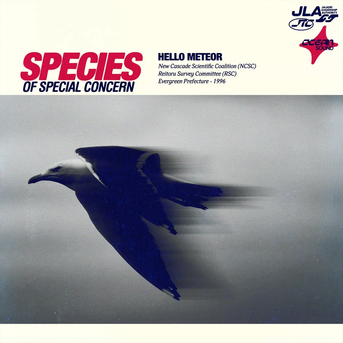
Species of Special Concern
Spotify / Apple Music / Bandcamp
====================
𝑅𝑎𝑖𝑛 𝑜𝑛-𝑤𝑜𝑟𝑙𝑑 𝑖𝑠 𝑎 𝑙𝑖𝑣𝑖𝑛𝑔 𝑑𝑜𝑐𝑢𝑚𝑒𝑛𝑡 𝑜𝑓 𝑒𝑣𝑒𝑟𝑦𝑤𝘩𝑒𝑟𝑒 𝑖𝑡 𝘩𝑎𝑠 𝑏𝑒𝑒𝑛.
-
An excerpt from: The Nagaoka Index, Vol. IV, Weather & Atmospheric Phenomena, Reitoru
Coral Press conditions are issued by the Daily Forecast when a fog storm of sufficient density and thermal origin moves along the inner coast of the Ocean Nagaoka and compresses against the Kaen Range. The designation accounts for the specific optical phenomenon produced when the marine layer interacts with light from both Kinzie and Vicars simultaneously during their offset rise and set windows. The result is a sustained coral and amber suffusion across the entire visible marine layer, distinct from standard overcast. Visibility in the West Ocean District and along the Ceramic District waterfront can drop to under 40 meters. The Taylor-Park Spire has been known to disappear entirely from street level before the event is formally announced.
People on-world call it Beni Kiri.
Jaladri is predominantly ocean. Evidence of geothermal activity has been recorded all along the crater ridge that forms the majority of the archipelago. The twin moons create extreme tidal cycles while the atmosphere is thick with intense moisture to the point where some on-world fauna have evolved to literally drink the air. Sometimes the marine layer, or even the Coral Blush, can become so significant that they demand their own classification as a Fog Storm, a rarer event, called a Coral Press.
In New Cascade, local geography can further potentiate these events. The key mechanism of this is the Kaen Mountain Range that runs almost the entire western coast of Reitoru, acting as a barrier against open ocean systems. These fog storms come from the opposite direction, moving along the surface of the Ocean Nagaoka into the inner curve of the archipelago. The Kaen Range holds these events, sometimes for days, over the city of New Cascade. If you lived in the Tantalus district at elevation, you would see these systems moving in like a pale nothing approaching north from the direction of Surakineau, obscuring everything in its path.
-
The Kaen Range is the oldest exposed rock on Jaladri. While the rest of the archipelago was built upward over millions of years by volcanic accumulation, the Kaen Range was pushed up by the impact that formed the crater, and has been slowly eroding downward ever since. It is the only landmass on the planet getting smaller rather than larger.
Unlike the porous lava field that New Cascade sits on, or the pyroclastic formations of the Ignisara, the rock is dense and dark. It is ancient material from the ocean floor.
Between the angular formations of this ancient impact rock, dusk clay accumulated over millions of years. Acidic rainwater dissolved it slowly, then quickly, finding pressure and gradient and following both downward through the range. What it left behind were chambers. Not rounded and smooth like the solutional caves near the coast, but almost resembling man-made angular structures.
The Waterfall Room is the largest known example of this formation in the Kaen Range.
The first fall drops from a shelf of ancient rock at the western approach, fed by a high altitude tributary of the Pthalo River originating deeper in the range. The second falls through a collapsed ceiling shaft 14 meters above the chamber floor, opened by the same dissolution process, now admitting both water and sky. The clay is entirely gone from the walls. What remains is bare ancient impact rock, glossy dark grey with shards of black and white. Residual mineral deposits run in horizontal bands at roughly eye level around the entire interior. Passing through the first curtain of water from the western approach, those bands appear briefly luminous.
The sound of both falls inside the chamber is all-encompassing. There is no frequency it does not occupy.
A cluster of Gathering Citrus grows in the upper shaft opening, rooted in the residual clay around the rim. By all documented parameters they should not receive sufficient light to survive at that depth and angle. They are producing fruit.
This location was first noted in the Preliminary Survey of High Altitude Bambusoid Flora, Kaen Interior Basin, Reitoru. N. Lukonde, 1967 - as “western interior cavity, unnamed, accessed via tributary descent”
-
An Excerpt from: On The Properties of Diffuse Light in Urban Environments - NCSC Built Environments Division - Published under NCSC Atmospheric and Architectural Research, New Cascade. Compiled and edited by the Center for Built Environments, O. Davis, 1972.
Jaladri sits inside a visual binary system. Kinzie, the primary star, is smaller than Earth's sun but comparable in luminance. Vicars is much smaller, appearing as a deep amber point during the day and a small red orb at sunset, setting an hour after Kinzie from a different position in the sky. For one hour every day, everything on the surface casts two shadows.
The installation known as Light Between Structures documented the specific ways both stars interact with natural and manmade formations on-world and gave way to an entirely new design language. Buildings constructed in New Cascade after this period were oriented not just for solar efficiency but for the quality of light produced when both stars share the sky simultaneously. The Ceramic District, with its dense downtown configuration, produces the most concentrated examples. In the hour before Vicars sets, the light moving between buildings at street level shifts from white to amber and the shadows double and then slowly collapse into one.
The moons contribute a separate register entirely. Makahoa shines bright blue in the night sky. Yurei, smaller and further out, moves behind it, pale and greenish. On clear nights in the Growing Season both are visible simultaneously and the light they produce together on open water, on glass buildings, on the mineral deposit bands running through exposed Kaen rock, has no single Earth comparison that satisfies.
-
An excerpt from: On The Contents of Rain - Planetary Weather Authority* (PWA) - Atmospheric Research Bulletin, Vol. III A Division of the New Cascade Scientific Coalition (NCSC), New Cascade
Clouds are not empty. Every water droplet requires a nucleus to form around, photic glitter from the Ikan Delta, fungal spores from Mondo Canyon, a fragment of marine material, a grain of coastal dust. The water builds itself around whatever the atmosphere offers and when it falls, brings all of it down.
Over Reitoru the source is predominantly oceanic. Weather systems crossing thousands of kilometers of open water arrive at the western coast carrying the inventory of everything they passed over. Microscopic marine organisms, trace minerals from the ocean floor drawn up in spray, or biological material from the bioluminescent algae blooming seasonally along the western shores. The Kaen Range intercepts these systems, reshapes them, and delivers them to New Cascade already altered by elevation and the specific mineral content of the range itself.
Rain on-world is a living document of everywhere it has been.
*The Planetary Weather Authority (PWA) operates as the primary atmospheric research and public broadcast division of the New Cascade Scientific Coalition (NCSC). Regional observation data is sourced from the Reitoru Survey Committee's (RSC) Atmospheric and Coastal Observation Division and from monitoring stations maintained across both islands. The Daily Forecast is a PWA production.
-
A large portion of usable water on-world is sourced through rainwater collection. During the Expansion Era, a specific class of structure emerged in New Cascade. Green roofed, deeply eaved, with integrated channel systems running the full perimeter of every level. The living gardens common to most large buildings on-world serve a dual purpose here; the root systems of the planted terraces act as the first stage of filtration before water even reaches the collection infrastructure below.
The most refined examples are in the Northcoast District. Residential structures built into the gentle slope of the terrain, oriented specifically to face the prevailing weather coming in off the West Ocean. On a heavy rain day, of which there are many, the sound inside these buildings is something particular. The water moving through the channel systems in the walls become a feature, a low continuous sound that residents describe as easier to sleep to than silence.
The lava rock substrate beneath New Cascade does the rest. Whatever the buildings do not collect, the ground filters. The city sits on a natural purification system two miles deep. The architects of the Expansion Era understood this and designed accordingly. The building catches what it can. The planet handles the rest.
It is, by any measure, a very sensible arrangement.
-
A comment from: Exo Planet Environmental Trust, Convergent Fauna Classification and Observation Record, Vol. IV In Association with the New Cascade Scientific Coalition
The formal designation exists for bureaucratic reasons. What it describes is something more quietly remarkable.
Jaladri has its own fauna. This is understood. What was not expected, and what still does not have a completely satisfying scientific explanation, is how many of them bear such close resemblance to creatures from a planet light years away.
The current working theory involves convergent evolution, the idea that similar environmental pressures produce similar biological solutions regardless of origin. It is a reasonable explanation. Most people accept it.
The most discussed example remains Larus Occidentalis Jaladria. Nearly identical to Earth's Western Gull in behavior, diet, and social structure. Double the size, blue beak, pink feet. Found on every coast on the planet without exception. It was one of the first creatures documented after First Landing. It has been watching humans on-world longer than most institutions have existed.
It does not seem particularly concerned.
-
The Western Slope.
Nobody formally named this area. It appears in RSC surveys under grid coordinates and in JTC records as a series of pending designation files that have been pending since 1992. Locally it is called The Western Slope, which is accurate if unimaginative, and has the particular quality of a name that was never meant to stick but did anyway.
During the construction of the Aquamarine Line, the southwestern edge of the Ceramic District became the primary staging zone for the western portion of the project. A decade of heavy industrial activity required somewhere to put itself. Flat usable land in the Ceramic District was already spoken for. Operations moved up the hillside.
The structures are white concrete, brutalist in the specific way that suggests the architect was given very little time and a very clear budget. They follow the grade of the terrain, stepping up the slope in irregular intervals, connected by external stairways and covered walkways that catch the rain and funnel it down in sheets. Years of Jaladri weather has stained the concrete in long vertical streaks. Green has colonized every horizontal surface with the particular ambition of Jaladrian flora given any foothold at all.
Some of them are occupied. The arrangements by which they are occupied are unclear. There are lights on at night in configurations that suggest habitation rather than storage. Laundry visible on the upper walkways. There is a small antenna array on the highest structure that does not correspond to any registered communications equipment in the RSC database.
From the Ceramic District below on a clear morning, the white structures catch the light from Kinzie directly overhead. Before Vicars rises, when the light is still singular, the whole slope looks briefly like something remembered from a dream.
Nobody has filed a complaint. Nobody has filed anything.
-
Planetary Weather Authority, Seasonal Observation Notes, Growing Season, PWA-NCSC, Reitoru.
There is a specific quality to early summer on Reitoru that has eluded straightforward description. Scientists have tried. The PWA issues it in forecast language as "high pressure, elevated thermal gradient, reduced marine layer activity" which is accurate and tells you almost nothing about what it actually feels like to be standing in it.
As the Rain Season closes and the Growing Season establishes itself, the Kaen Range begins to do something it does not do the rest of the year. The rock absorbs heat. Ancient dense impact rock, the oldest surface material on the planet, holds thermal energy with extraordinary efficiency. By mid morning the western faces of the range are radiating that stored heat back outward and downward toward the city. The air coming down off the mountains is not the cool mountain air one might expect, it is warm and dry and carries the specific scent of the high altitude rainforest. Lukonde's Bamboo. Gathering Citrus warming on the ridge. Jaladrian Arabica on the eastern slopes releasing something between coffee and cut grass into the air above New Cascade.
It is not a hot day by any Earth standard most people would remember. A warm afternoon in early summer on Reitoru is the planet briefly in agreement with itself. The long rains dwindling, the dark seasons months off, and everything growing at a rate that is almost audible if you sit still long enough in the right place.
-
RSC Coastal Survey Division, Southern Reitoru, JLA Environmental Research Directive 7.
South of The End of All Known Land the coast is not accessible by road. The Kaen Range meets the West Ocean directly and remains there for approximately 60 kilometers until the terrain subsides above Surakineau. What exists along this stretch is documented by aerial survey and periodic marine observation only.
There are four small survey installations in this zone. All are permanent in designation if not always in staffing. Resupply is conducted by marine vessel during favorable sea conditions. Pelican Craft drops are used otherwise. The Lounzé Tides make scheduling irregular. Rotations are 90 days. Extensions are not uncommon.
Infonet coverage does not exist in this zone. Equipment is hardline only. All data is physically retrieved at resupply.
The installations monitor atmospheric conditions, coastal erosion rates, oceanic current patterns, and geological activity along the fault systems running beneath the southern Kaen Range. The data feeds into PWA forecast modeling and RSC coastal documentation. It is patient work performed in conditions that do not encourage anything else.
Personnel are selected through a separate application process from standard RSC postings. The criteria are not publicly listed.
Retrieval logs are current. All installations are accounted for.

Home

New Music

Album Archive

Merch

Trash